Stop paying per-acre cloud fees and uploading confidential survey coordinates to third-party servers. TerraScan turns raw drone imagery, DJI LiDAR, and multispectral sensors into millimeter-accurate Orthomosaics, classified 3D terrain models, and hyper-realistic CUDA 3D Gaussian Splats with zero recurring subscription extortion.
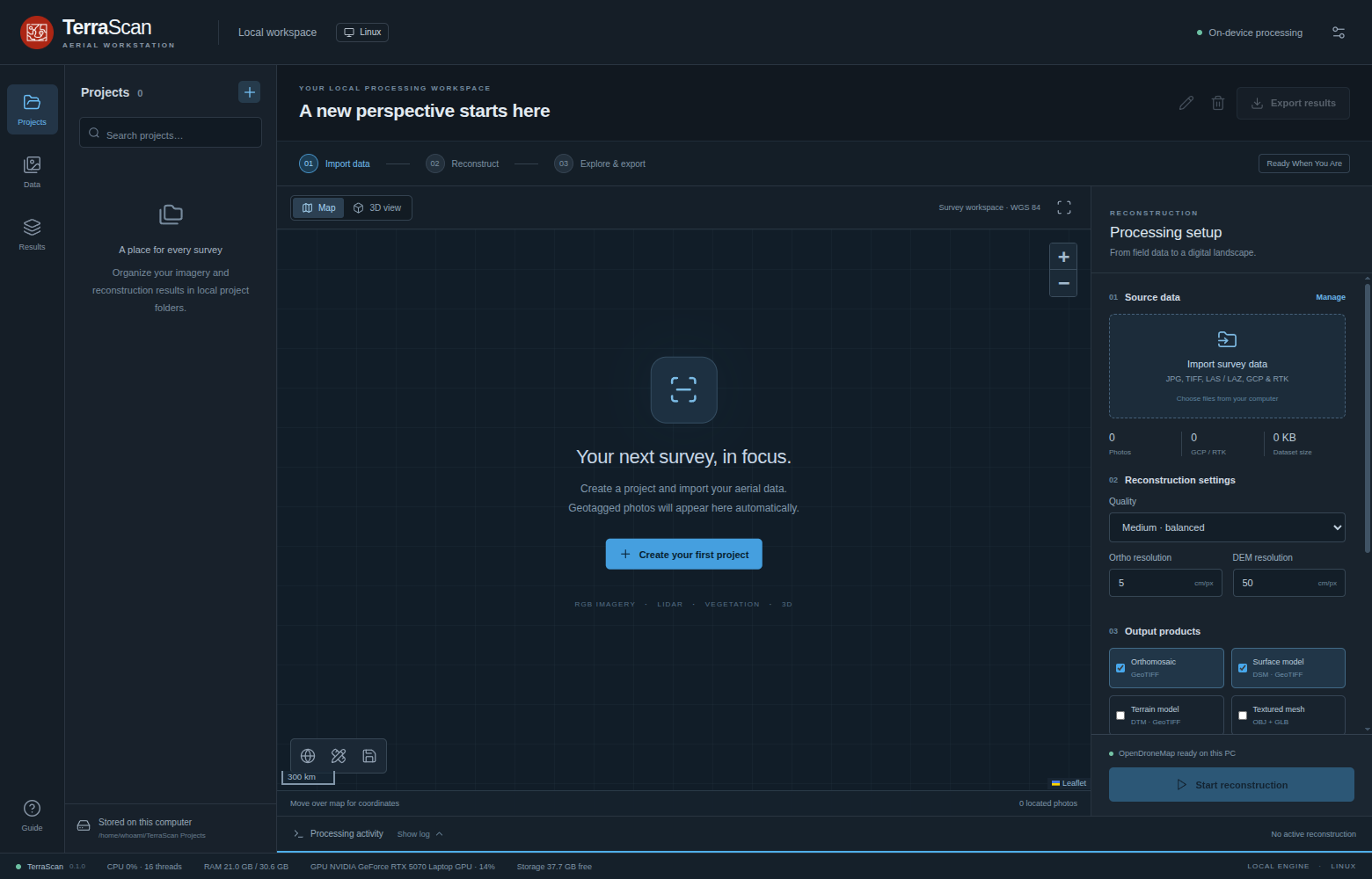
Click between outputs to see how TerraScan transforms complex flight surveys into actionable engineering deliverables.
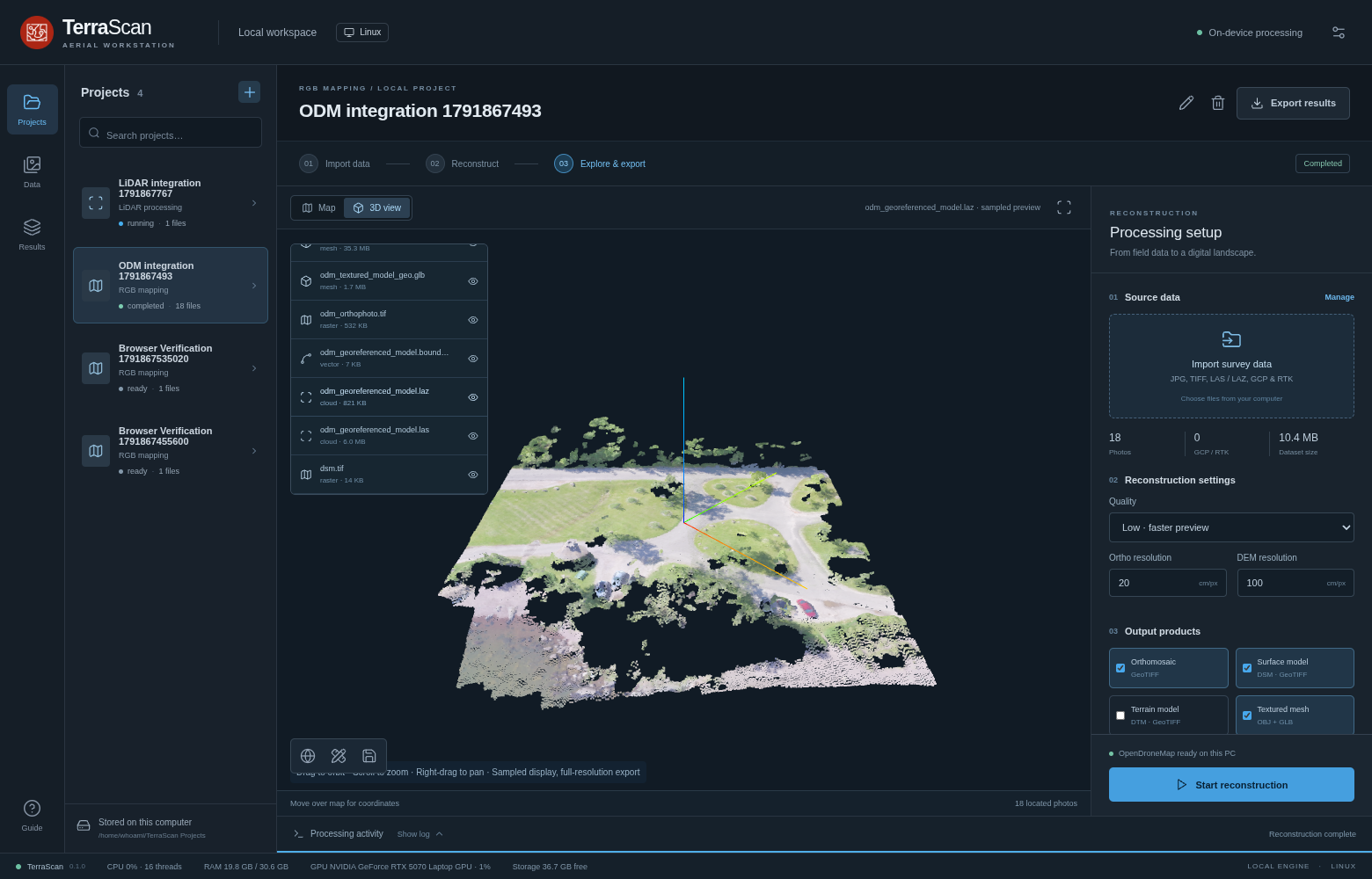
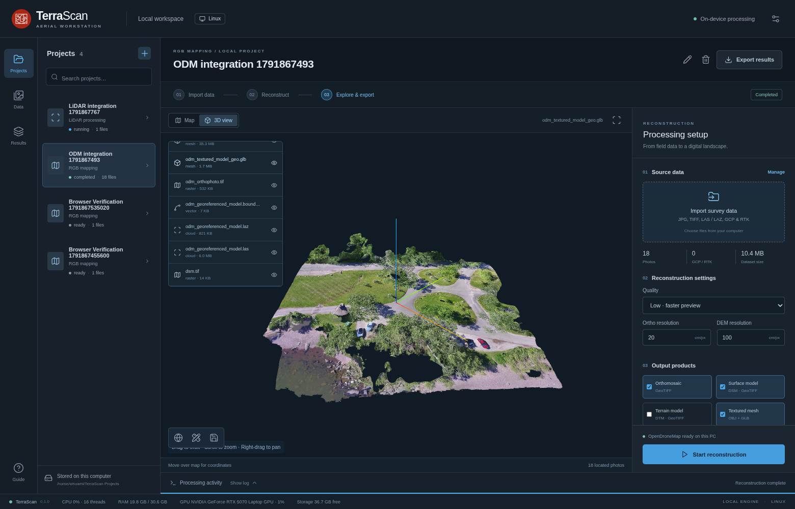
Clean, mission-focused desktop interface inspired by enterprise survey software. Manages multi-flight projects, raw sensor inputs, POS trajectory solutions, and real-time GPU/CPU resource allocation on your physical PC.
From civil engineering topography and agricultural health indices to high-fidelity 3D asset inspection — TerraScan replaces fragmented point solutions with an integrated pipeline.
Sub-centimeter GSD orthophotos with automatic radiometric blending and seamline optimization. Exports as standard GeoTIFF with full world/projection files (.pgw, .prj) for instant QGIS/ArcGIS ingestion.
Ingest multi-gigabyte LAS/LAZ files. Execute PDAL SMRF terrain filtering, extract bare-earth Digital Terrain Models (DTM), non-ground building structures, and generate precise elevation contours.
Step beyond polygon limitations. Harness NVIDIA CUDA and Nerfstudio (Splatfacto) to train photorealistic radiance fields, producing continuous, high-definition 3D splats (.ply) with real-time inspection.
Built-in local PPK engine using RTKLIB for rover/base RINEX processing. Interactive Ground Control Point (GCP) marking with sub-pixel bundle optimization and custom projected metric Coordinate Systems (EPSG).
Automated band calibration and calculation for NDVI, NDRE, VARI, and GNDVI indices. Generate clear false-color stress maps to monitor crop vigor, nitrogen status, and canopy density.
Export Web Mercator XYZ tiles (zoom up to 24) in ZIP/MBTiles for offline web maps. Produce OGC 3D Tiles (PNTS point clouds and B3DM meshes) for instant Cesium and web-based 3D geospatial viewers.
Unlike vendor-locked software that forces you into closed ecosystems or proprietary licenses, TerraScan works with standard and industry-standard aerial sensors:
Native trajectory decoding and SBET ingestion, RPOS quaternion resolution, and seamless LAS/LAZ point cloud derivation.
Full EXIF and DJI XMP metadata extraction. Handles high-overlap oblique, nadir, and corridor flight plans up to 100MP per shot.
Green, Red, RedEdge, and NIR channel separation for calibrated scientific vegetation and agronomy indices.
Cloud photogrammetry services charge $200–$600/month or $0.50–$2.00 per acre. See how much your firm saves every year by running TerraScan on your own hardware.
Saved every single year compared to typical cloud processing fees.
Built for survey professionals who demand total data sovereignty, maximum processing speed, and transparent pricing.
| Feature / Metric | TerraScan | Cloud Mapping SaaS | Proprietary Workstation |
|---|---|---|---|
| Data Privacy & Security | 100% Air-Gapped Local PC | Uploaded to third-party cloud | Local with periodic phone-home |
| Recurring Pricing | Zero Per-Acre / Zero Sub | $180 – $600 / mo + per gigabyte | $3,500 – $6,000 upfront + annual fee |
| 3D Gaussian Splatting (CUDA) | Built-in (Nerfstudio/CUDA) | ❌ Not Available | ❌ Proprietary mesh only |
| LiDAR Ground Classification | PDAL SMRF (Class 2 Ground) | Basic or paid add-on tier | Vendor-restricted algorithms |
| GIS Export Compatibility | GeoTIFF, LAS, SHP, MBTiles, 3D Tiles | Export download quotas | Proprietary exchange layers |
| Offline Capability | 100% Offline (No Internet needed) | ❌ Useless without high-speed web | Needs periodic license ping |
TerraScan is optimized to leverage every CPU core, NVMe storage channel, and NVIDIA Tensor core on your workstation.
Download our comprehensive Manual User Guide (PDF), request the Windows/Linux installer, or schedule a customized technical briefing for your survey operations.